
The ground is cleared. Where does the rain go?
Follow the route, not just the muddy spot. A ditch, an inlet and a sediment barrier each answer a different part of the runoff question.
On a cleared Arkansas site, rain may soak in, collect in low ground or flow downhill into a ditch, inlet or stream. Flowing water can carry exposed soil. The useful question is where that water leaves the site, and what happens along the way.
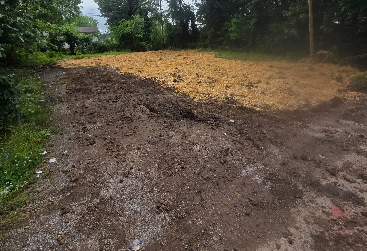
The muddy spot is only one frame
A puddle catches your eye. The route beyond it tells you more. Where does water go once the low spot fills? Does it cross a drive, enter an inlet or follow a ditch? A dry-weather photograph cannot answer all of that.
Separate the route drawn on a drainage plan from the route observed during rain. Arkansas DEQ explains that stormwater can carry soil, litter and chemicals. Its construction-stormwater page provides coverage information, a pollution-prevention-plan template and an inspection form. A local government may hold a different part of the file: Rogers, for example, reviews development-related drainage and public improvements.
Sources: Arkansas Division of Environmental Quality: General Stormwater Permits · City of Rogers: Community Development
Cover the soil. Guide the water. Catch the sediment.
Those are different jobs. EPA separates construction practices into erosion, runoff and sediment control. That helps explain why one fence cannot stand in for an entire drainage system. Our field-reading guide connects what you see with what to ask.
| Visible feature | Question it raises |
|---|---|
| Straw, cover or vegetation | How is exposed soil protected from erosion? |
| A swale or lined channel | Where is flow meant to travel and discharge? |
| Silt fence or inlet protection | Which sediment pathway is being controlled? |
| A basin or trap | What drains into it, and what does its maintenance record show? |
A useful observation follows the water
From a safe public location, note the time, recent rain, nearest public location, direction of flow and first ditch or inlet it reaches. Photograph the route as well as the muddy spot. “Water crossed the drive into that inlet” is an observation. Naming a pollution source takes more evidence.
Ask the city or county for the drainage or grading plan and the office that receives stormwater concerns. Ask about coverage and inspections without assuming every record lives in the same file. A plan describes intent; dated observations and inspection records help explain performance. A single photograph cannot establish a permit violation.
Sources: Arkansas Division of Environmental Quality: General Stormwater Permits · City of Rogers: Community Development
Have a question this story leaves open? Send it to the editorial desk. See something we should correct? Read our corrections policy. Material factual changes receive a dated note here.